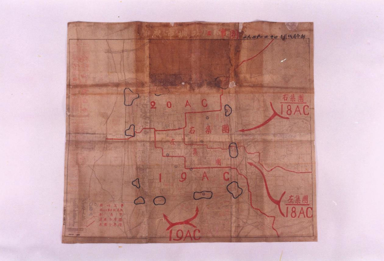
This is the Taiyuan City Defense Fortification Map used by the PLA Taiyuan frontline command at the general offensive stage of the Taiyuan Campaign. With a scale of 1:5000, the map is made up of 6 parts. The title “Taiyuan City Defense Fortification Map” is in faded handwriting; by the title is the brush handwriting of “April 14, 1949, at the frontline headquarters;” and the words reading “February 16, 1949, headquarters of the 1st Corps of the North China Field Army of the Chinese People’s Liberation Army” are printed on the lower left edge, which indicates that the map was originally drawn by the headquarters of the 1st Corps (reorganized on March 1, 1949 to the 18th Corps). The bottom of the map shows the distribution of roads and buildings in Taiyuan, which have faded and blurred. The map shows the distribution of the enemy’s core fortifications and commanding heights in blue, and the assembly areas and offensive operations of the 18th, 19th and 20th corps of the PLA in red.
After the victory of the Beiping-Tianjin Campaign, the Central Military Commission ordered the 18th, 19th and 20th corps to capture Taiyuan in middle March 1949. In the early hours of April 20, our army launched a general attack on Taiyuan. By the evening of the 22nd, the enemy defenders outside the city were wiped out. On the morning of the 24th, the artillery division used more than 1300 cannons to bombard the “Battling City” from all sides, which led to the collapse of all the core fortifications and commanding heights in the city as marked on the military map. Taiyuan, an important city in North China, was liberated.
In 1959, it was transferred by the Beijing Military Command to the Military Museum.